Basemaps & Historical Imagery
Satellite basemaps and the historical imagery timeline
Basemap sources
The Basemap section under Sources offers several satellite/hybrid basemaps (Google Hybrid, Bing Aerial, ESRI World Imagery, Mapbox Satellite, HERE Satellite, Google Satellite, OpenStreetMap) plus any custom source you've added — see Bring Your Own Data.
OpenStreetMap is OpenFreeMap's Liberty vector style rather than raster tiles, so it stays crisp at any zoom and can extrude OSM buildings with their recorded heights — the 3D switch on its row toggles them.
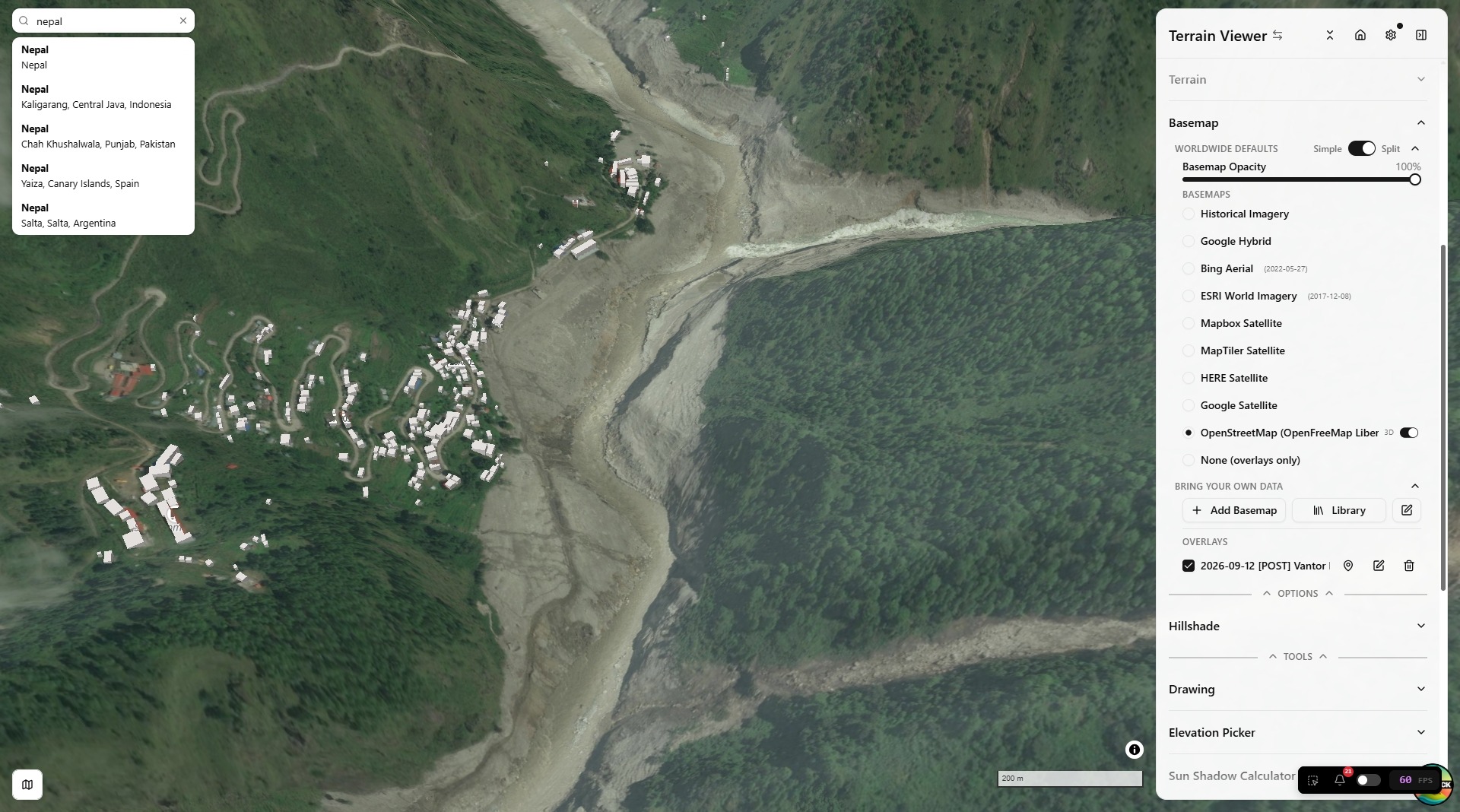
In split view (grid layouts up to 4×2 / 8 views, labeled A–H), each basemap row shows an A–H button grid so a different source can be assigned per view. Clicking a row's label (not just its A–H buttons) sets every active view in the current grid layout to that source in one click — handy for putting a whole 4×2 comparison grid onto Historical Imagery without clicking each pane individually.
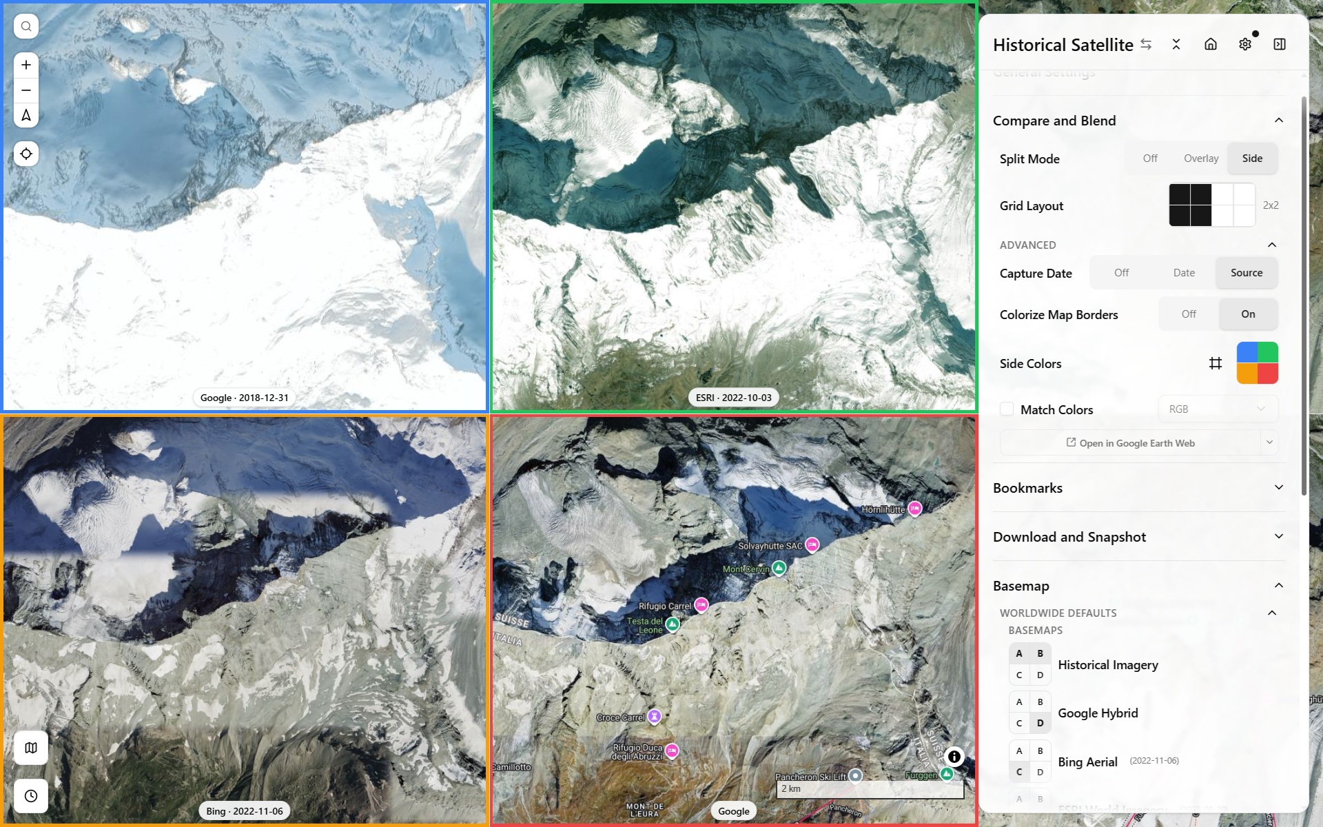
Basemap comparison, Side grid mode
Historical Imagery mode
"Historical Imagery" is a single combined basemap entry covering four underlying providers:
- ESRI Wayback — dated releases of ESRI World Imagery (see the dev page for how this app resolves a date to a release)
- HLS (Harmonized Landsat/Sentinel-2) — monthly, coarser resolution
- Google Earth Historical — occasional very old outlier captures for well-covered areas, via a reverse-engineered
gehist://protocol scaffolded from Iconem's own GE_TimeMachine (see the protocol deep dive for how it actually works) - Planet Monthly Mosaic — requires an API key
Which one actually renders for a given view/date is chosen via the timeline panel at the bottom of the map, not the sidebar. Each provider gets there differently — see the dev pages for the two most involved.
A 4×2 grid mixing three of the four providers across different capture dates over the same spot (Île de la Cité, Paris) makes the resolution/coverage gap between them obvious at a glance:
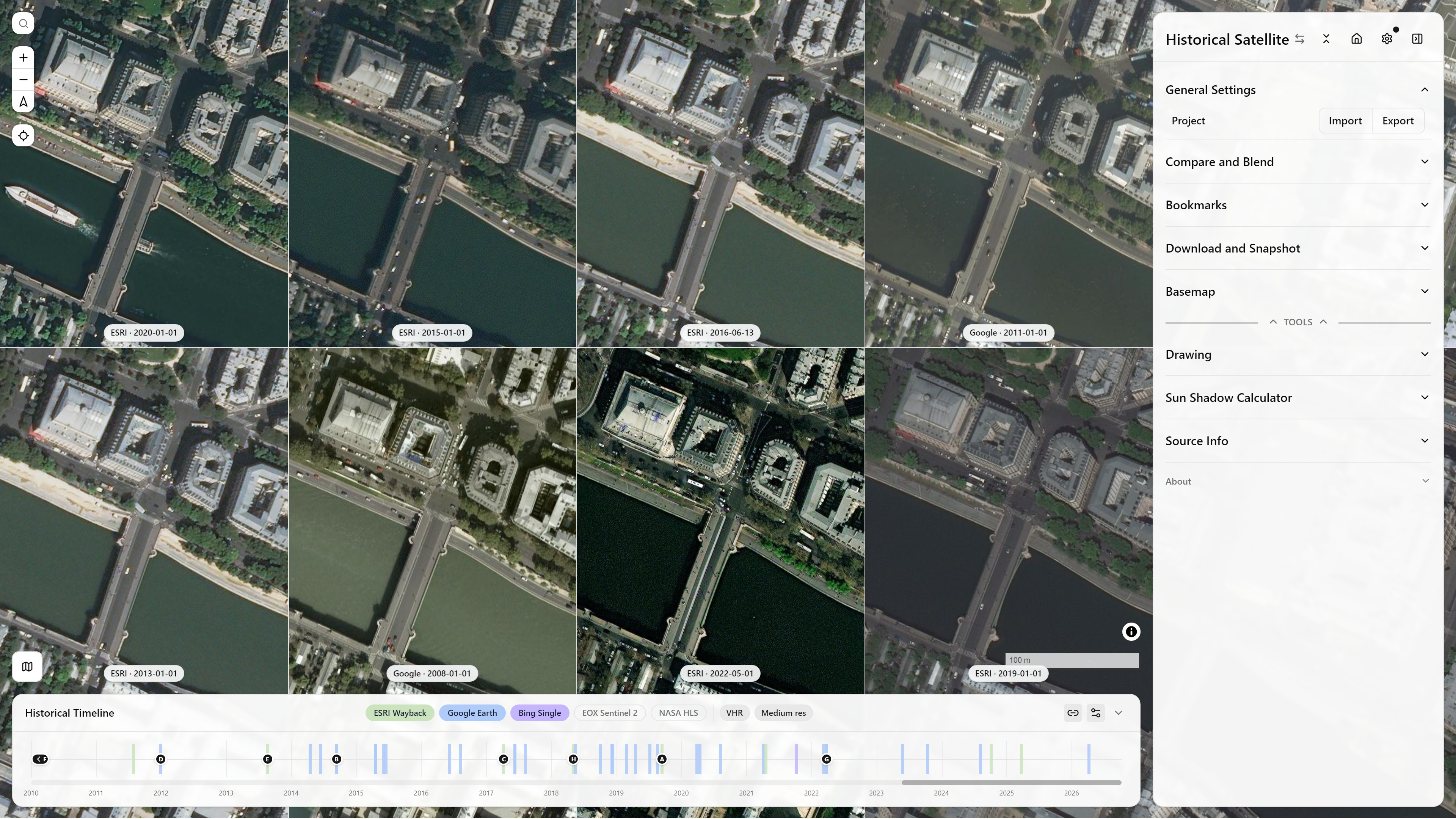
Historical Imagery, Split Mode Side (4×2) — ESRI Wayback and Google Earth Historical mixed across capture dates — Île de la Cité, Paris — see Split & Compare Modes for how the grid itself works
The timeline panel
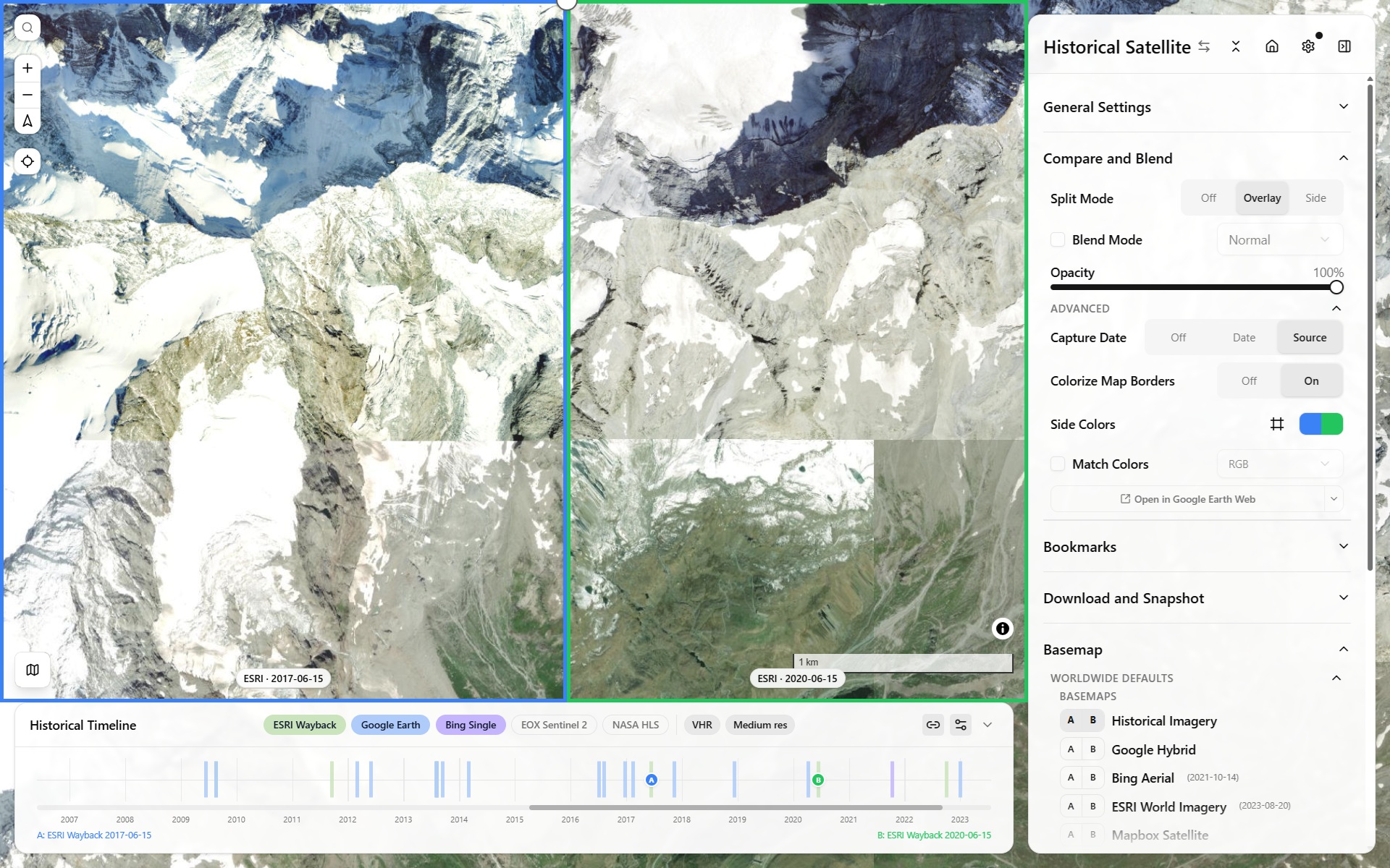
Historical timeline panel — scrubbing capture dates across providers
- Each active view gets a draggable handle on the timeline, positioned at its currently selected capture date.
- Source pills toggle which providers contribute ticks to the shared timeline; resolution-class filters (VHR vs. medium) narrow it further.
- Zoom: mouse wheel zooms the timeline in/out around the cursor; a trackpad two-finger swipe pans. The zoom-out limit extends slightly (10% per side) past the oldest/newest real tick, so those extreme marks always have breathing room instead of sitting flush against the track's edge.
- Pan gutter: when zoomed in, a small gutter below the track shows where the current window sits within the full range — drag it, or click it, to jump.
- An off-screen handle shows a chevron; clicking it nudges the relevant edge of the view window out to reveal it.
Wayback and Google Earth Historical are the two genuinely different architectures behind that timeline (release-chained catalog vs. self-contained-per-tile protocol); HLS and Planet are both simple monthly-mosaic lookups:
Dedicated historical-imagery entry point
The app's appMode (terrain | historical) controls whether the full sidebar or a stripped-down historical-imagery-only sidebar is shown — see the in-app Mode Picker (click the sidebar title). It's a shareable/bookmarkable URL param (?appMode=historical) like every other setting.
Visiting historical-satellite.iconem.com (and any subdomain of it) defaults straight into Historical mode on a first visit, with no query param needed — the main terrain-viewer.iconem.com deploy (or any other/unknown domain, a fork, localhost, a preview URL) keeps the normal Terrain default. Once you've explicitly switched modes in your browser on a given domain, that choice is remembered for next time.