Terrain and Basemap Sources
The built-in DEM tile sources (Mapterhorn, Mapbox, MapTiler, AWS Terrain Tiles, Esri World Elevation) and worldwide basemap providers
The Sources group in the sidebar covers two independent pickers — Terrain (the DEM driving elevation/relief/exaggeration) and Basemap (the imagery draped on top, or shown as Raster Basemap) — see Overview → Sidebar groups for where this sits relative to the rest of the app. Both accept your own sources too, not just the built-ins below — see Bring Your Own Data.
The built-ins on this page are worldwide tilesets. For the government LiDAR services bundled alongside them — 0.5 m for France and the Netherlands, 1 m for Norway, England and the USA — see National Open-Data Terrain.
Terrain
Every built-in terrain source streams raster-dem tiles (Terrarium or Mapbox Terrain-RGB encoding) — pick one from Sources → Terrain, or click its ⓘ (info) icon there for the same summary shown here plus a ready-to-run GDAL export command.
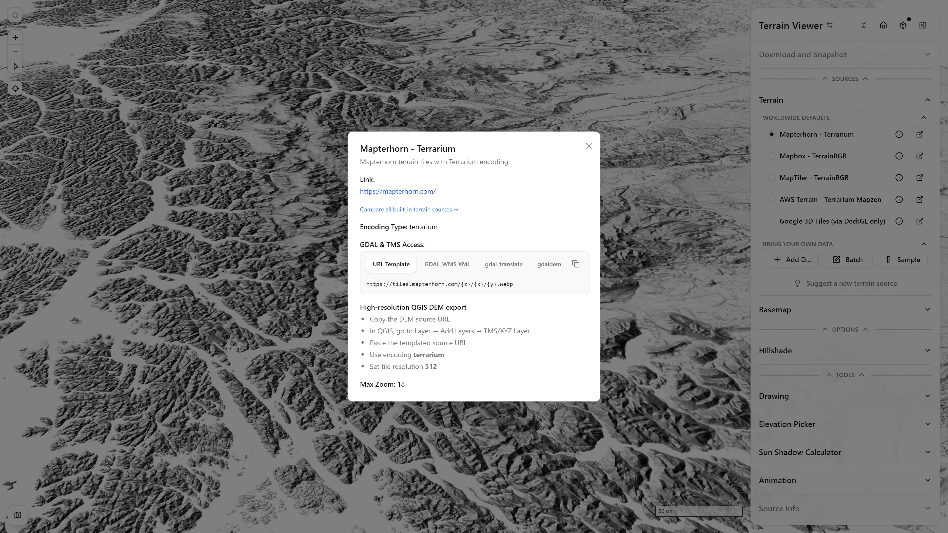
Terrain source info dialog (Mapterhorn) — Patagonia, Chile — open in app ↗
Mapterhorn — Terrarium
mapterhorn.com · Terrarium encoding · zoom 18 · 512px tiles
An open, community-run "Protomaps for terrain" project: a global low-resolution base (ESA Copernicus GLO-30) with high-resolution national LiDAR data swapped in wherever it's available — its own coverage page maps out exactly which regions get the sharper zoom-13+ tiles.
Mapbox — Terrain-DEM v1
docs.mapbox.com · Terrain-RGB encoding · zoom 14 · 256px tiles
Global coverage at 0.1m elevation increments — a compressed, optimized successor to Mapbox's original Terrain-RGB v1 tileset. Only available through Mapbox's own SDKs (not the plain Raster Tiles API), and requires a Mapbox API key.
MapTiler — Terrain-RGB v2
maptiler.com/terrain · Terrain-RGB encoding · zoom 12 · 512px tiles
A composite of multiple high-resolution DEMs curated by MapTiler's geodata team — ~30m resolution globally, down to 5m in several European countries. MapTiler also publishes a separate "Ocean RGB" tileset for bathymetry, though this app only wires up the land-elevation Terrain-RGB one. Requires a MapTiler API key.
AWS Terrain Tiles — Terrarium (Mapzen)
registry.opendata.aws · Terrarium encoding · zoom 16 · 256px tiles
The original open Tilezen/Joerd dataset (built by Mapzen, continuing as an AWS Open Data Registry mirror after Mapzen's shutdown) — the only built-in source with genuine ocean bathymetry: land elevation (SRTM at mid/high zoom, GMTED2010 at low zoom) is blended with global ETOPO1 bathymetry everywhere water replaces a zero-elevation gap, plus regional high-resolution inserts (US 3DEP/NED, ArcticDEM, EU-DEM, Canada's CDEM, and more). No API key needed.
Which dataset is actually under my cursor?
Esri World Elevation — LERC
Esri's global best-available blend (Vantor, Airbus DS, USGS, NGA, NASA, CGIAR, GEBCO, Land Information New Zealand, Ordnance Survey and others), in its TopoBathy form: land and seafloor as one continuous surface, so a hypsometric ramp or a 3D view reads across a coastline instead of stopping at it. The second built-in with real bathymetry, alongside AWS Terrain Tiles.
No API key. Unlike the others it is not an RGB packing at all — it streams LERC, Esri's own float raster codec, decoded in the browser by lerc://. Heights are orthometric (measured at −0.6 m mean against a reference DEM), and real data runs to about z16.
A land-only variant, with the ocean flat at 0 m rather than the seafloor, is in the Library — worth choosing when a coastline should be a hard edge, since a −7000 m trench sharing the range wrecks a ramp keyed to land relief.
These are Esri ArcGIS services. They answer without a token and with CORS open, but Esri's Terms of Use contemplate use with ArcGIS products, and consuming them from a non-Esri client is not clearly granted — worth checking before relying on one in anything published.
The Source Info tool (Tools group in the sidebar) hints at exactly that for the terrain/basemap that's currently exposed at your viewport — e.g. which of Mapterhorn's composited national LiDAR datasets is active at that location (vs. its global Copernicus GLO-30 fallback), or which date/release the active ESRI imagery resolves to. Handy for knowing whether you're looking at a genuinely high-resolution local dataset or a coarser global default.
Basemap Sources
The Basemap section under Sources offers several satellite/hybrid TMS providers, all built-in with no setup required beyond an API key where noted:
- Google Hybrid — satellite + roads/labels
- Google Satellite — satellite only
- Bing Aerial
- ESRI World Imagery
- Mapbox Satellite — requires a Mapbox API key
- HERE Satellite — requires a HERE API key
- OpenStreetMap — vector-style street map, not satellite
Plus the combined Historical Imagery entry (ESRI Wayback, HLS, Google Earth Historical, Planet) — see Basemaps & Historical Imagery for the four providers behind it and how the timeline resolves a date to a tile.